Satellite, Aerial & Drone Imagery in Hail Appraisals
Satellite and aerial imagery help place a storm in time and map its footprint, but drone imagery answers the roof-level questions an appraisal of the amount actually turns on. Here is how each fits.
By Marshall Smith, IAUA CPAU Certified Insurance Appraiser · Published September 30, 2026 · 7 min read · Filed under Storm Damage
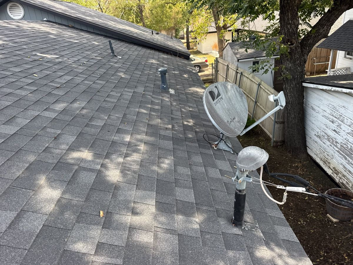
In a hail damage appraisal, satellite and aerial imagery are best at answering the wide questions — when a storm passed and how far its footprint reached — while low-altitude drone imagery answers the close questions the amount of loss actually turns on, such as the density, size, and distribution of impacts on a specific slope. No single altitude does everything. A well-built appraisal file uses each source for the question it can genuinely answer and does not stretch any of them past their resolution. This post walks through what each layer of imagery contributes, where one hands off to the next, and what a property owner should ask an appraiser to include.
What each altitude of imagery is actually good at
Think of imagery as a series of zoom levels, each with a different job.
Satellite imagery gives you the broadest context. It can help establish that a property sits inside a region where a storm system moved through and show large-scale changes over time when older and newer captures are compared. What it usually cannot do is resolve an individual hail bruise on a shingle. The distance is simply too great for that level of detail on most publicly and commercially available imagery.
Aerial imagery — captured from aircraft rather than orbit — sits in the middle. It is closer, often sharper, and can reveal roof-level patterns such as displaced shingles, missing ridge caps, or debris fields that suggest wind and hail activity. It is still a top-down view, so anything that depends on angle, texture, or touch tends to escape it.
Drone imagery, flown at low altitude under FAA Part 107 rules, closes the gap. It captures a roof slope by slope, at oblique and overhead angles, close enough to document individual impact marks, mat fracture, granule loss, and the spatial pattern of hits across a plane. This is the resolution an appraisal of the amount of loss usually needs, because scope is built at the level of individual roof components. You can read more about how this fits a claim on our drone inspection page.
Placing the storm in time and mapping its reach
One of the most common questions in a hail file is when the damage happened and whether the property fell within the affected area. Imagery helps here, but with limits worth stating plainly.
Comparing captures from before and after a suspected date can show change on a roof that was not present earlier — a useful corroboration when the date of loss is contested. Wide-area imagery can also help visualize the general path a storm system followed, supporting a narrative that a particular neighborhood sat within it.
What imagery does not do is prove, on its own, that a specific stone of a specific size struck a specific roof on a specific day. Anyone stating a precise hail measurement for a given address and date should be able to point to the record it came from. In our files, imagery is treated as corroboration that sits alongside weather records, inspection notes, and physical evidence — never as a standalone verdict on the event. If you are working through how the date of loss interacts with a claim, our guide to hail damage roof claims in Texas covers the timeline questions in more depth.
Where satellite hands off to drone
The practical rule is: match the resolution to the question being asked.
If the question is regional — did a storm system cross this county, is this property inside the broad footprint — satellite and aerial imagery carry most of the weight. If the question is specific — how many impacts per test square on the south slope, is this granule loss consistent with hail or with age and foot traffic — that is a drone or hands-on question, because it depends on detail no orbital image resolves.
Most disputed hail appraisals live in the second category. The disagreement is rarely about whether a storm happened; it is about the extent and characterization of damage on this roof. That is exactly where low-altitude drone imagery earns its place, and why an appraiser who relies only on distant imagery is often answering a different question than the one in dispute.
Tying imagery to an itemized roof scope
Imagery is only as useful as its connection to the line items in an estimate. A photograph of a damaged slope means little to the amount of loss until it is tied to a specific quantity — squares of shingles, linear feet of ridge, counts of vents and flashings — inside a structured estimate.
In practice, drone and ground imagery are indexed to the roof diagram and to the Xactimate scope so each documented condition maps to a corresponding line. Overhead drone captures also support accurate measurement of roof area and slope, which drives quantities. When imagery and scope are built to reference each other this way, the appraisal panel can see precisely what a given number represents rather than debating an unlabeled photo.
Why the ground still matters
Imagery — even excellent drone imagery — has limits, and a careful appraiser respects them.
Some damage is tactile. A hail bruise can be felt as a soft spot before it is clearly visible; mat fracture may need close examination; the difference between hail impact and blistering, mechanical damage, or manufacturing defect often requires a hands-on look and an experienced eye. Interior conditions, attic moisture, and decking damage sit entirely outside any aerial view. Weather, sun angle, and roof color can all affect what a lens picks up.
This is why imagery supports ground verification rather than replacing it. The strongest hail files combine wide-area context, low-altitude drone detail, and direct inspection, so that no single method has to carry a conclusion it cannot support alone.
How imagery evidence is weighed in an appraisal
It helps to be clear about what an appraisal panel does with any of this. Appraisal determines the amount of loss — the scope and cost to repair or replace the damaged property. Whether a given loss is covered at all is a separate determination under the policy, made by the carrier and, where the parties disagree, resolved by a court — never by the appraisers or the umpire.
Within that lane, imagery is evidence like any other: it is weighed for what it reliably shows. Each side selects its own independent appraiser, and where the two appraisers cannot agree on an item, a neutral umpire decides it. Well-organized, honestly labeled imagery tends to narrow disagreements because it lets both appraisers reason from the same visual record. Overstated imagery — a distant shot presented as proof of a close-up condition — does the opposite. For how this process runs end to end, see our overview of hail damage insurance appraisal.
What to request from your appraiser
If you are engaging an appraiser on a hail claim, ask a few concrete questions about imagery.
Ask whether they capture their own low-altitude imagery under FAA Part 107 and how it is tied to the estimate. Ask how they corroborate the storm context without overstating what wide-area imagery can show. Ask whether ground verification accompanies the aerial work, and how conditions that require touch or interior access are documented. Ask, finally, how all of it is organized so the panel — and if needed the umpire — can follow each number to the evidence behind it. Property owners across the DFW metro increasingly expect this layered approach, and it is a fair thing to expect.
Talk through your roof file before the season turns
If you have a hail claim and are trying to understand what imagery your file needs, Marshall Services offers a free consultation. Marshall Smith is an IAUA Certified Professional Appraiser with FAA Part 107 drone certification and works independently as either party appraiser or neutral umpire. Call 972-322-0752 to talk it through.
Frequently Asked Questions
Can satellite imagery prove hail hit my specific roof?
No — satellite imagery is generally too distant to resolve individual hail impacts on a single roof. It is best used to establish broad context, such as whether a property sits within the area a storm system crossed, and to show large-scale change when older and newer captures are compared. Proving damage on a specific slope typically requires low-altitude drone imagery and hands-on inspection, with imagery treated as corroboration alongside other records rather than standalone proof.
What is the difference between a drone roof inspection and a satellite view?
A drone flies at low altitude and captures a roof slope by slope, close enough to document individual impacts, granule loss, and mat fracture, while a satellite view is a distant top-down image suited to regional context, not shingle-level detail. The two answer different questions: satellite imagery frames where a storm reached, and drone imagery documents the condition of your particular roof, which is usually what an amount-of-loss appraisal turns on.
Does drone imagery replace an in-person roof inspection?
No — drone imagery supports a hands-on inspection but does not replace it. Some hail damage is tactile, such as soft bruising or mat fracture, and interior, attic, and decking conditions sit outside any aerial view. Sun angle, roof color, and weather can also affect what a lens captures. The strongest files combine wide-area context, low-altitude drone detail, and direct inspection so no single method has to carry a conclusion alone.
Does imagery decide whether my hail claim is covered?
No. Imagery is evidence used to help determine the amount of loss — the scope and cost of repair. Whether a loss is covered at all is a separate determination under the policy, made by the carrier and, where the parties disagree, resolved by a court, never by the appraisers or the umpire. Within appraisal, imagery is weighed for what it reliably shows about the extent of damage, not for any coverage question.
How does imagery connect to the repair estimate?
Imagery becomes useful to the amount of loss when each documented condition is tied to a specific line and quantity in a structured estimate. Overhead drone captures support accurate roof measurements that drive quantities like squares of shingles and linear feet of ridge, while close images are indexed to the roof diagram so each number references the evidence behind it. That linkage lets the appraisal panel see exactly what a given figure represents.